
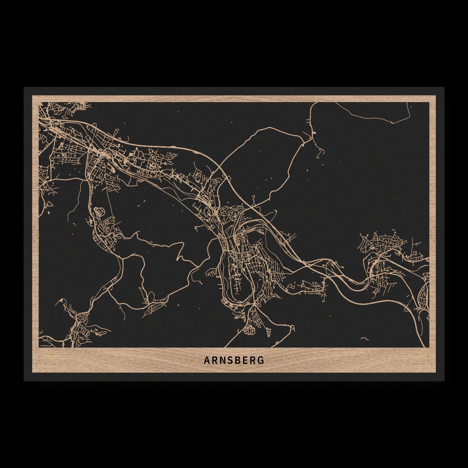
Arnsberg.Historic seat and valley districts
Rectangular wooden city map made from oiled oak – two layers with a black back plate.
About the product
Arnsberg's historic centre occupies elevated ground, while neighbouring districts follow the valley. The castle hill, Niedereimer, Bruchhausen and Rumbeck establish the extent of this urban landscape. This wooden city map brings winding connections together with more compact settlement areas. It links the former seat of power with its surrounding valley districts, revealing the distinctive shape of eastern Arnsberg.
What does the map show?
- Arnsberg castle hill
- Niedereimer
- Bruchhausen
- Rumbeck
- Precisely cut and engraved
- Fine laser details with clear depth
- Carefully inspected and securely packed
- Handmade in Germany
Configuration
Shape: Rectangular · Design: Layered · Material: Oak · Sizes: 20 × 30 cm, 35 × 50 cm, 50 × 70 cm
The configuration shown in the cart and at the time of ordering is authoritative. The preview is not a dimensioned technical drawing.
Availability & production
- Availability
- Made to order
- Production time
- Ships in 3-5 business days
Production starts after successful payment and complete product configuration.
Materials & care
Depending on the variant, lacquered or oiled MDF or oiled real-wood veneer on MDF; optional stainless-steel mounting screws. Acrylic lacquer spray, hard-wax oil and white glue are used in production.
Wood is a natural material. Grain and color may vary slightly from the product images.
Clean with a dry, soft cloth and protect from prolonged moisture and direct heat.
Included & installation
The selected product in the ordered configuration, securely packed and prepared for installation.
- Maximum dimensions 50 × 70 cm and maximum product weight 2 kg.
- Wall-fixing screws and wall plugs are not included. Use fixings suitable for the wall type, substrate and product weight.
- Installation must be carried out by an adult. Keep optional mounting screws and other small parts away from children until installation.
Shipping & returns
Securely packed shipping. Return and cancellation information is available in the legal section.
Shipping costs and delivery options depend on the destination and format. The published cancellation right applies to non-personalised standard goods; it may be excluded for individually made products.
Manufacturer & product identifier
- Manufacturer
- Benjamin Nöst - Lightworks
Rorichmoorer Str. 76
26802 Moormerland, Deutschland
kontakt@lightworks.de - Product identifier
- LW-CAT-1D5F55332B10-S, LW-CAT-1D5F55332B10-M, LW-CAT-1D5F55332B10-L
Together with the order or production batch, the relevant SKU enables traceability. Safety questions and incidents can be reported to the email address shown above.
Product safety
- Decorative product for dry indoor use only; not a toy and not intended for children.
- Protect from moisture, high heat and open flames.
- Do not continue to hang the product after a fall, breakage or visible damage. Keep damaged parts away from children.
Arnsberg: Historic seat and valley districts
Counts, electoral government and Prussian administration each contributed to Arnsberg's importance. The landscape explains how that history took physical form. The elevated castle site and the neighbouring valley settlements belong to a city whose routes and built areas had to respond closely to hills, water and the available ground.
Power on the hillside
Arnsberg's castle hill brings political history and topography into a close relationship. The counts of Arnsberg shaped the medieval settlement from an elevated position, with the town developing below. The compact historic centre therefore follows the possibilities of a ridge rather than an arbitrary geometric plan. Its arrangement becomes clearer when considered alongside the surrounding valley.
Town rights are recorded in 1238, and the county passed to the Electorate of Cologne in 1368. Changes of government altered Arnsberg's political setting without removing its established spatial focus. The castle site remained a reference point. Its surviving ruins also demonstrate that continuity of place does not require buildings to remain intact throughout their history.
A regional administrative role
After the political upheavals around 1800, Arnsberg came under Prussian rule in 1816. It developed into an administrative centre serving a wider region. Government offices and courts added another function to the former seat of power. Administration became a lasting part of the city's identity rather than a brief episode following its medieval history.
These layers occupy a relatively concentrated area. Older authority and later civic functions stand close together, while the surrounding terrain limits even expansion in every direction. Growth had to follow valleys and available connections. The result is an elongated, articulated city rather than a settlement spreading uniformly around one centre.
Neighbouring places along the valley
Niedereimer and Bruchhausen lie northwest of the historic centre, while Rumbeck occupies a southeastern position. Their distribution widens the picture from the castle hill to the larger eastern settlement area. Built districts alternate with landscape transitions, making the routes between them especially important. Those connections turn separate local centres into a shared everyday geography.
The present municipality was formed in 1975 from several formerly independent places. Its administrative territory extends well beyond this eastern urban group. Even within the neighbouring districts considered here, however, the reasons for Arnsberg's multiple centres are apparent.
The castle hill, valley neighbourhoods and older settlements contribute different elements to the city. Political history explains the prominence of the former residence; topography explains the paths along which its surroundings developed. Understanding both reveals how an elevated medieval centre became part of a wider, connected valley town.
Sources
- (Stadt-)Geschichtliches — https://www.arnsberg.de/wohnen-leben/kultur/stadtarchiv/stadt-und-landstaendearchiv/stadt-geschichtliches
- Stadt Arnsberg — https://www.o-sp.de/download/arnsberg/21940
- Zeittafel Stadt Arnsberg — https://www.arnsberg.de/fileadmin/user_upload/Bilder_und_pdf-Dateien/0.6/Baukultur/Faltblatt_Historisches-Alt-Arnsberg.pdf
- Archivalien — https://www.arnsberg.de/wohnen-leben/kultur/stadtarchiv/stadt-und-landstaendearchiv/archivalien

Still deciding?
Configure your motif in the studio and see how your city map will look in your space.