
Brandenburg an der Havel.Island town and historic centres
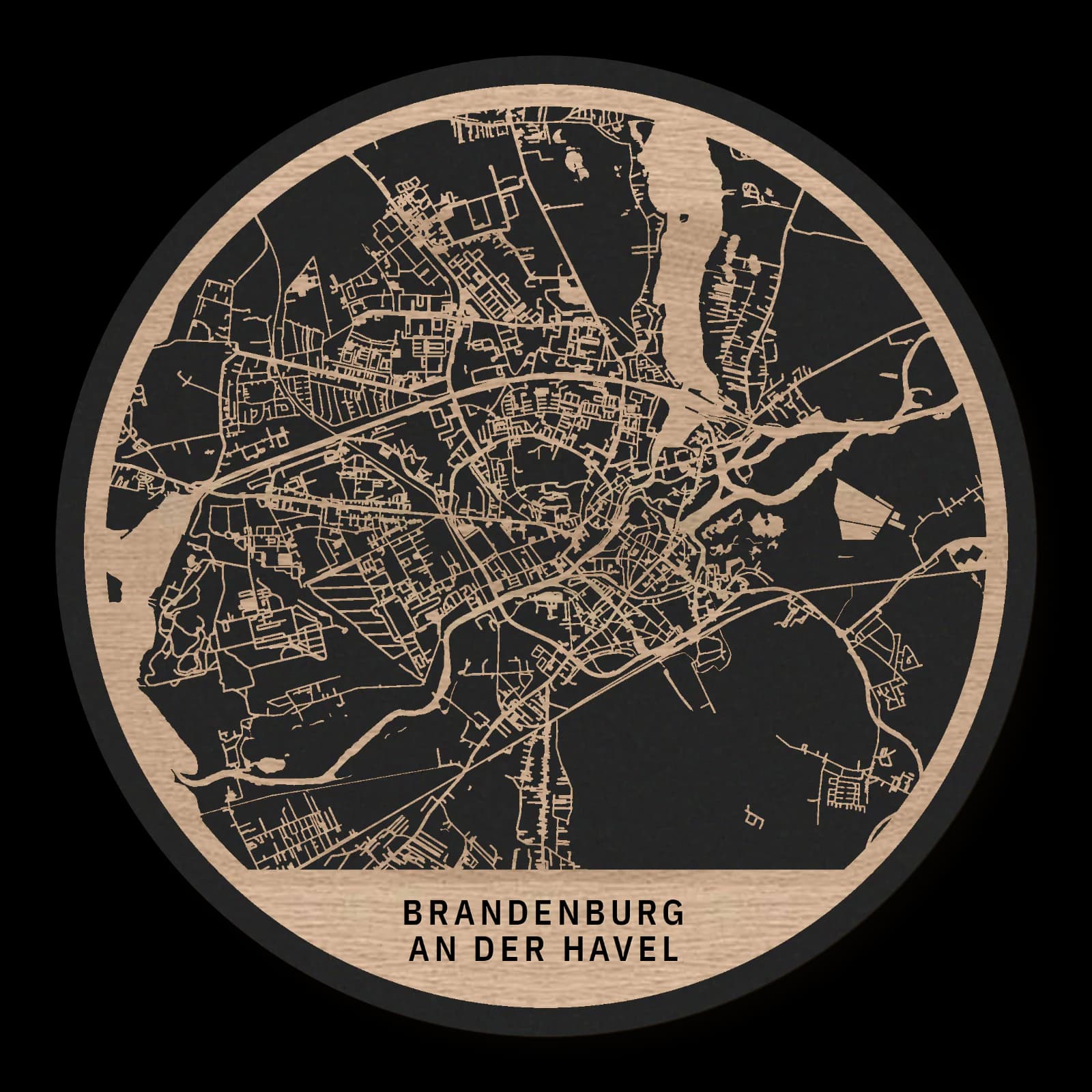
Round wooden city map made from oiled oak – two layers with a black back plate.
About the product
Brandenburg an der Havel distributes its historic centres across islands, banks and neighbouring urban areas. The cathedral island, Neustadt and Marienberg shape the composition, with the main station extending it southwards. This wooden city map brings waterways and built ground into close relationship. It portrays a town whose coherence developed through connections between several older centres.
What does the map show?
- Cathedral island
- Marienberg
- Neustadt
- Brandenburg main station
- Precisely cut and engraved
- Fine laser details with clear depth
- Carefully inspected and securely packed
- Handmade in Germany
Configuration
Shape: Round · Design: Layered · Material: Oak · Diameter: Ø 23 cm, Ø 35 cm, Ø 50 cm
The configuration shown in the cart and at the time of ordering is authoritative. The preview is not a dimensioned technical drawing.
Availability & production
- Availability
- Made to order
- Production time
- Ships in 3-5 business days
Production starts after successful payment and complete product configuration.
Materials & care
Depending on the variant, lacquered or oiled MDF or oiled real-wood veneer on MDF; optional stainless-steel mounting screws. Acrylic lacquer spray, hard-wax oil and white glue are used in production.
Wood is a natural material. Grain and color may vary slightly from the product images.
Clean with a dry, soft cloth and protect from prolonged moisture and direct heat.
Included & installation
The selected product in the ordered configuration, securely packed and prepared for installation.
- Maximum dimensions 50 × 70 cm and maximum product weight 2 kg.
- Wall-fixing screws and wall plugs are not included. Use fixings suitable for the wall type, substrate and product weight.
- Installation must be carried out by an adult. Keep optional mounting screws and other small parts away from children until installation.
Shipping & returns
Securely packed shipping. Return and cancellation information is available in the legal section.
Shipping costs and delivery options depend on the destination and format. The published cancellation right applies to non-personalised standard goods; it may be excluded for individually made products.
Manufacturer & product identifier
- Manufacturer
- Benjamin Nöst - Lightworks
Rorichmoorer Str. 76
26802 Moormerland, Deutschland
kontakt@lightworks.de - Product identifier
- LW-CAT-C070899ED900-S, LW-CAT-C070899ED900-M, LW-CAT-C070899ED900-L
Together with the order or production batch, the relevant SKU enables traceability. Safety questions and incidents can be reported to the email address shown above.
Product safety
- Decorative product for dry indoor use only; not a toy and not intended for children.
- Protect from moisture, high heat and open flames.
- Do not continue to hang the product after a fall, breakage or visible damage. Keep damaged parts away from children.
Brandenburg an der Havel: Island town and historic centres
Brandenburg developed through several centres rather than one unified old town. The cathedral precinct, Altstadt and Neustadt had distinct roles before becoming more closely integrated. Water continued to organise their relationships. Marienberg and the southern railway district add topographical and transport landmarks to this inherited, multi-part urban structure.
More than one beginning
Brandenburg an der Havel has a distinctly multi-centred history. The cathedral precinct, Altstadt and Neustadt developed as separate areas, with religious, civic and administrative functions located close together. Their proximity did not immediately make them one town. Altstadt and Neustadt were united in 1715, while the cathedral district joined much later. This sequence helps explain the several focuses still present in the urban layout.
The cathedral island preserves the position of the religious centre within a watery setting. It differs from a church inserted into an otherwise continuous street grid. Island, buildings and crossings form a connected geographical unit. The water helps explain the precinct's historical independence as well as its present appearance.
A historic Neustadt
Neustadt lies south of the cathedral area. Despite its name, it is an old urban district rather than simply a modern extension. Its own history needs to be recognised alongside that of the neighbouring centres. Roads and bridges gained importance precisely because they connected places that had once been distinct.
Water continues to divide the city into differently sized spaces. Built blocks alternate with banks and open ground. This produces a pattern unlike that of a town developing across uninterrupted dry land. Orientation depends on the relationship between channels, crossings and historic centres. Those relationships remain legible even where individual buildings have been replaced.
A hill and a railway connection
Marienberg, west of the cathedral island, provides a topographical counterpoint to the low water landscape. The elevated open space introduces another kind of landmark close to the built city. It connects urban life with a change in terrain rather than another dense concentration of buildings.
A southern transport layer
The main station marks a later layer to the south. It links Brandenburg with the regional railway system and extends its urban geography beyond the earlier centres. The space between station, Neustadt, cathedral island and Marienberg brings together places formed under very different circumstances.
Their coexistence gives Brandenburg its distinctive character. A religious island, established civic districts, a green hill and railway infrastructure contribute separate elements to one connected city. Its unity emerged by linking inherited differences, not by replacing them with a single uniform pattern. Understanding those differences makes the broader town considerably easier to read.
Sources
- Geschichte - Stadt Brandenburg an der Havel — https://www.stadt-brandenburg.de/stadt/stadtportrait/geschichte
- BRANDENBURG AN DER HAVEL | Dehio DE — https://de.dehio.org/stadtgeschichte/brandenburg-der-havel
- Brandenburg an der Havel - Arbeitsgemeinschaft Städte mit historischen Stadtkernen des Landes Brandenburg — https://ag-historische-stadtkerne.de/historische-stadtkerne/brandenburg-an-der-havel/
- Geschichte Brandenburg an der Havel – 1.000 Jahre Historie - Erlebnis Brandenburg an der Havel — https://erlebnis-brandenburg.de/geschichte-und-geschichten

Still deciding?
Configure your motif in the studio and see how your city map will look in your space.