
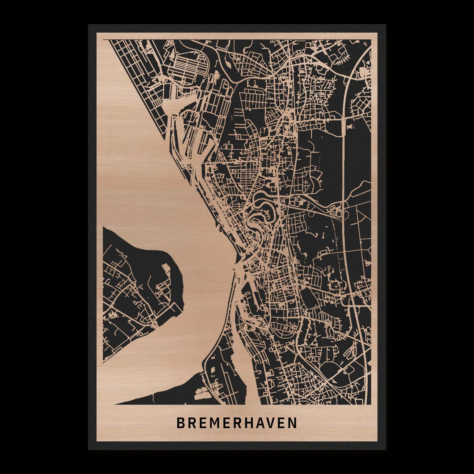
Bremerhaven.Port city from the fishing harbour to Speckenbüttel
Rectangular wooden city map made from oiled beech – two layers with a black back plate.
About the product
Harbour basins and elongated neighbourhoods set Bremerhaven's rhythm. Translated into wood, this composition connects the fishing harbour with Klimahaus and the green northern setting of Speckenbüttel. Christuskirche gives Geestemünde a clear reference within the urban fabric. Water, residential streets and generous open spaces share the view, revealing an inhabited port city whose maritime character reaches beyond its best-known waterfront attractions.
What does the map show?
- Southern fishing harbour
- Klimahaus beside the central harbour
- Christuskirche in Geestemünde
- Northern Speckenbüttel park
- Precisely cut and engraved
- Fine laser details with clear depth
- Carefully inspected and securely packed
- Handmade in Germany
Configuration
Shape: Rectangular · Design: Layered · Material: Beech · Sizes: 20 × 30 cm, 35 × 50 cm, 50 × 70 cm
The configuration shown in the cart and at the time of ordering is authoritative. The preview is not a dimensioned technical drawing.
Availability & production
- Availability
- Made to order
- Production time
- Ships in 3-5 business days
Production starts after successful payment and complete product configuration.
Materials & care
Depending on the variant, lacquered or oiled MDF or oiled real-wood veneer on MDF; optional stainless-steel mounting screws. Acrylic lacquer spray, hard-wax oil and white glue are used in production.
Wood is a natural material. Grain and color may vary slightly from the product images.
Clean with a dry, soft cloth and protect from prolonged moisture and direct heat.
Included & installation
The selected product in the ordered configuration, securely packed and prepared for installation.
- Maximum dimensions 50 × 70 cm and maximum product weight 2 kg.
- Wall-fixing screws and wall plugs are not included. Use fixings suitable for the wall type, substrate and product weight.
- Installation must be carried out by an adult. Keep optional mounting screws and other small parts away from children until installation.
Shipping & returns
Securely packed shipping. Return and cancellation information is available in the legal section.
Shipping costs and delivery options depend on the destination and format. The published cancellation right applies to non-personalised standard goods; it may be excluded for individually made products.
Manufacturer & product identifier
- Manufacturer
- Benjamin Nöst - Lightworks
Rorichmoorer Str. 76
26802 Moormerland, Deutschland
kontakt@lightworks.de - Product identifier
- LW-CAT-8C9ABCE5C5E0-S, LW-CAT-8C9ABCE5C5E0-M, LW-CAT-8C9ABCE5C5E0-L
Together with the order or production batch, the relevant SKU enables traceability. Safety questions and incidents can be reported to the email address shown above.
Product safety
- Decorative product for dry indoor use only; not a toy and not intended for children.
- Protect from moisture, high heat and open flames.
- Do not continue to hang the product after a fall, breakage or visible damage. Keep damaged parts away from children.
Bremerhaven through harbours and inhabited districts
Bremerhaven stretches alongside the water as an elongated city. Its harbour areas tell different stories, while Geestemünde and Speckenbüttel reveal daily life beyond the quays. Between the fishing harbour, Klimahaus, Christuskirche and park, maritime work, residential neighbourhoods and contemporary culture become parts of the same urban setting.
Several histories beside the water
Bremerhaven cannot be described through a single harbour panorama. Different port facilities and settlement centres contributed to the present city. The municipal historical account emphasises that a relatively young port city also incorporates older inhabited places. This layering helps explain the changing situations across its length: broad water spaces, connected residential streets and distinctive districts follow one another. The elongated shape makes distances within the city noticeable. Yet the maritime orientation remains a shared reference even where a harbour is not immediately outside the door. Work beside the water and life in the neighbourhoods form complementary parts of the same urban landscape.
The fishing harbour and Geestemünde
Fishing Harbour I lies south of the central harbour and cultural attractions. Its history relates closely to the development of a specialised port economy. A basin creates a different urban space from an open promenade: quays, access routes and practical uses give the water a defined shape. Nearby, Christuskirche provides a clear reference within the residential district of Geestemünde. Its position helps explain the transition from harbour infrastructure to an inhabited neighbourhood. The two settings belong together geographically while serving different purposes. Their proximity shows how the city developed through places of work as well as the everyday spaces of local communities.
A harbour setting for contemporary culture
Klimahaus occupies the central harbour area and represents the contemporary cultural use of maritime urban locations. Around it, harbour geometry, public routes and the architecture of a visitor attraction meet. It offers a useful reference for considering change in the city without overlooking its working history. The basins remain part of the spatial order even when individual functions evolve. Walking through this area means entering more than the surroundings of one building: water shapes distances, outlooks and the relationship between routes. This openness makes the area noticeably different from the more closely inhabited streets of nearby districts and provides another pace of urban experience.
The northern city through Speckenbüttel
Speckenbüttel park offers a different introduction to northern Bremerhaven. Here a green recreation space comes to the foreground, with the central harbour basins considerably farther south. That separation matters: alongside its well-known visitor attractions, the city includes neighbourhoods experienced through local routes and open spaces. Between park and fishing harbour stretches a connected urban setting that cannot be reduced to one landmark or the water's edge. Considering these different areas together reveals Bremerhaven as an extended sequence of living, work, culture and recreation. Its maritime identity remains strong, but acquires an equally important everyday dimension, with inhabited streets contributing as much to the character of the city as the quays.
Sources
- Bau und Geschichte des Fischereihafens I – Bremerhaven.de — https://www.bremerhaven.de/de/freizeit-kultur/stadtarchiv/geschichte-der-stadtteile/fischereihafen/bau-und-geschichte-des-fischereihafens-i.51277.html
- Stadtgeschichte Bremerhavens – Bremerhaven.de — https://www.bremerhaven.de/de/freizeit-kultur/stadtarchiv/stadtgeschichte-bremerhavens.13195.html
- Bremerhaven: Öffentliche Kultur- und Veranstaltungsorte — https://www.bremerhaven.de/de/veranstaltungen/veranstaltungsorte/veranstaltungsorte-fuer-besucher.48290.html

Still deciding?
Configure your motif in the studio and see how your city map will look in your space.