
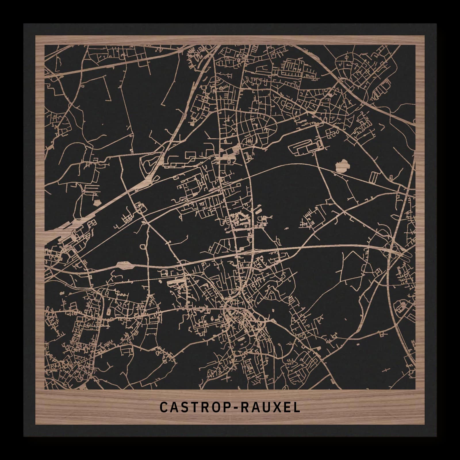
Castrop-Rauxel.Colliery landscapes and districts
Square wooden city map made from oiled walnut – two layers with a black back plate.
About the product
Castrop-Rauxel brings colliery sites, an older manor and several residential districts into one urban landscape. Erin, Bladenhorst Castle, the Schwerin spoil heap and Habinghorst extend the composition in different directions. Their relationships shape this wooden city map. Large industrial plots, smaller streets and green spaces reveal a city assembled from several historic settlement centres.
What does the map show?
- Erin colliery
- Bladenhorst Castle
- Schwerin spoil heap
- Habinghorst
- Precisely cut and engraved
- Fine laser details with clear depth
- Carefully inspected and securely packed
- Handmade in Germany
Configuration
Shape: Square · Design: Layered · Material: Walnut · Sizes: 23 × 23 cm, 35 × 35 cm, 50 × 50 cm
The configuration shown in the cart and at the time of ordering is authoritative. The preview is not a dimensioned technical drawing.
Availability & production
- Availability
- Made to order
- Production time
- Ships in 3-5 business days
Production starts after successful payment and complete product configuration.
Materials & care
Depending on the variant, lacquered or oiled MDF or oiled real-wood veneer on MDF; optional stainless-steel mounting screws. Acrylic lacquer spray, hard-wax oil and white glue are used in production.
Wood is a natural material. Grain and color may vary slightly from the product images.
Clean with a dry, soft cloth and protect from prolonged moisture and direct heat.
Included & installation
The selected product in the ordered configuration, securely packed and prepared for installation.
- Maximum dimensions 50 × 70 cm and maximum product weight 2 kg.
- Wall-fixing screws and wall plugs are not included. Use fixings suitable for the wall type, substrate and product weight.
- Installation must be carried out by an adult. Keep optional mounting screws and other small parts away from children until installation.
Shipping & returns
Securely packed shipping. Return and cancellation information is available in the legal section.
Shipping costs and delivery options depend on the destination and format. The published cancellation right applies to non-personalised standard goods; it may be excluded for individually made products.
Manufacturer & product identifier
- Manufacturer
- Benjamin Nöst - Lightworks
Rorichmoorer Str. 76
26802 Moormerland, Deutschland
kontakt@lightworks.de - Product identifier
- LW-CAT-CF2AF8C21A75-S, LW-CAT-CF2AF8C21A75-M, LW-CAT-CF2AF8C21A75-L
Together with the order or production batch, the relevant SKU enables traceability. Safety questions and incidents can be reported to the email address shown above.
Product safety
- Decorative product for dry indoor use only; not a toy and not intended for children.
- Protect from moisture, high heat and open flames.
- Do not continue to hang the product after a fall, breakage or visible damage. Keep damaged parts away from children.
Castrop-Rauxel: Colliery landscapes and districts
Castrop-Rauxel emerged through the union of several settlements after mining had already accelerated their growth. Older places such as Bladenhorst Castle survived beside industrial land. Their coexistence helps explain a city with several centres, contrasting plot sizes and a recurring alternation between built districts and open spaces across the urban area.
Joining established settlements
Castrop appears in written records as early as the ninth century. Its older settlement developed long before the industrial expansion that transformed the region. Mining brought employment and a growing population, requiring new housing and services. Neighbouring places became more closely connected before Castrop-Rauxel was established as a unified city in 1926.
This history explains the absence of one dominant organising centre. Older cores, residential extensions and large industrial sites retained different spatial patterns. Municipal unity brought those patterns together rather than replacing them. Roads became essential links between areas that had not originated as parts of a single plan.
Industrial land and a new landform
The former Erin colliery occupies a position close to central Castrop. Its extensive ground records the requirements of coal production: connected plots, technical buildings and transport access. Industrial work introduced a larger scale beside the older streets. That physical structure continued to matter after the original activity ended.
To the east, the Schwerin spoil heap records another stage of the mining process. Material was accumulated until it created a landform. The site consequently belongs to the history of landscape as well as labour. Colliery and spoil heap represent different operations within the same economy, distributed across the wider town.
An older estate and northern housing
Bladenhorst Castle lies northwest of the central districts. Its water setting and historic buildings point to an earlier organisation of land. The estate was not created by industrial planning. Instead, it survived within surroundings whose later purposes changed substantially. It preserves a pre-industrial layer beside the newer city.
Habinghorst extends the urban picture northwards. This district reveals the residential scale of Castrop-Rauxel beyond its best-known heritage sites. Housing and connecting routes occupy much of the ground between the historic and industrial reference points.
Together, these places explain several kinds of urban space: an inherited settlement, a production site, an artificial hill and established residential neighbourhoods. Bladenhorst adds the geography of an older estate to that combination. Castrop-Rauxel's character emerges from their coexistence. Its development joined places and economic periods that had different requirements, leaving those differences legible within one connected city rather than smoothing them into a uniform townscape. The districts retain local identities within that shared urban geography.
Sources
- Sehenswertes | Castrop-Rauxel — https://www.castrop-rauxel.de/tourismus/sehenswertes
- Stadtgeschichte | Castrop-Rauxel — https://www.castrop-rauxel.de/stadtgeschichte
- Regionalverband Ruhr: Masterplan Emscher Landschaftspark — https://www.rvr.ruhr/fileadmin/user_upload/01_RVR_Home/02_Themen/Umwelt_Oekologie/Emscher_Landschaftspark/PDFs/2010_Masterplan_Emscher_Landschaftsplan.pdf

Still deciding?
Configure your motif in the studio and see how your city map will look in your space.