
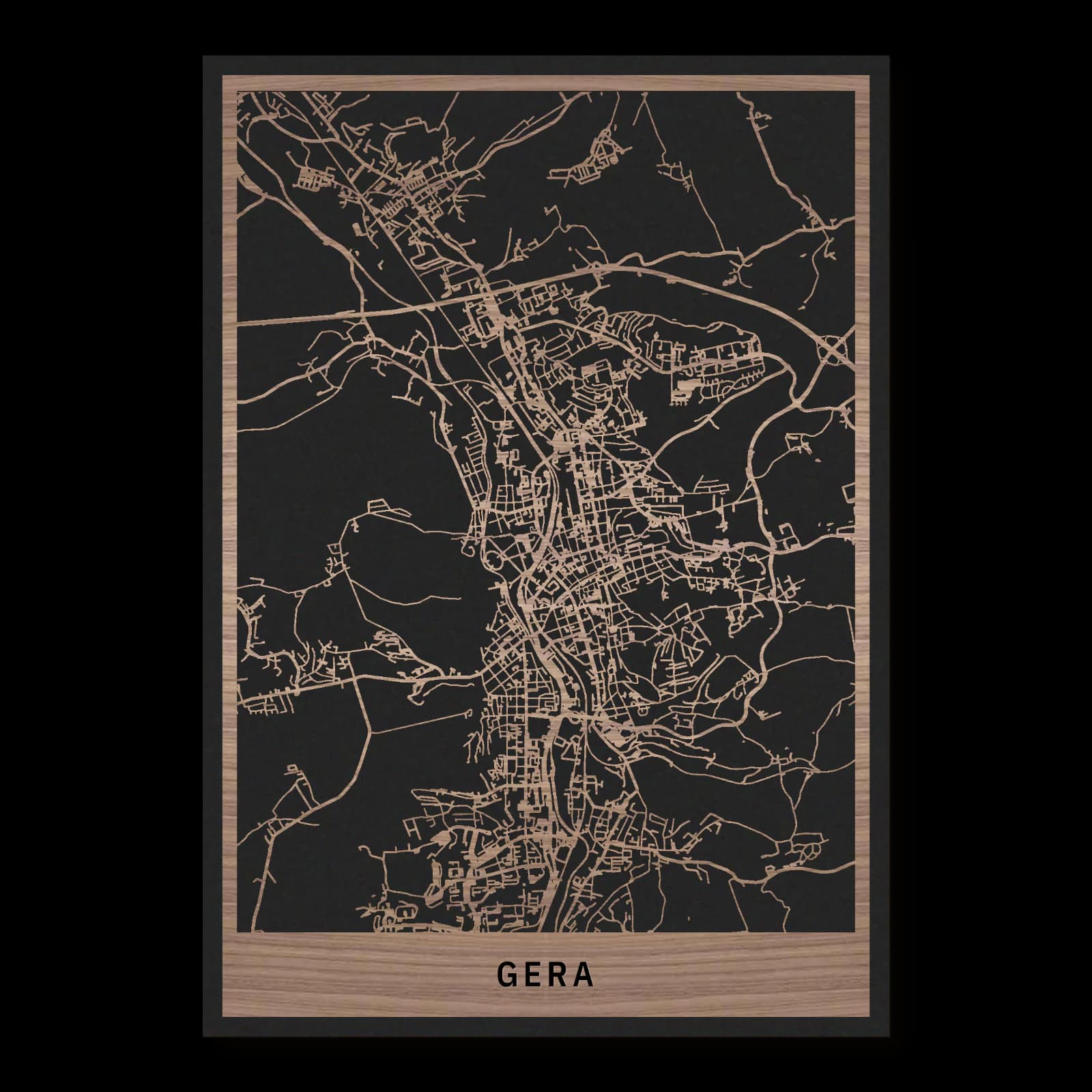
Gera.City Overview
Rectangular wooden city map made from oiled walnut – two layers with a black back plate.
About the product
A long valley and wooded slopes give Gera its distinctive outline. The town hall, Orangery and routes towards the Ferberturm reveal a city of compact streets and generous green spaces. This wooden city map brings those contrasting patterns together, extending beyond the old centre to show how residential neighbourhoods, cultural buildings and the surrounding landscape form one connected urban setting.
What does the map show?
- Untermhaus and the civic centre
- Open space at Hofwiesenpark
- Hillside references at Ferberturm and Fuchsturm
- Precisely cut and engraved
- Fine laser details with clear depth
- Carefully inspected and securely packed
- Handmade in Germany
Configuration
Shape: Rectangular · Design: Layered · Material: Walnut · Sizes: 20 × 30 cm, 35 × 50 cm, 50 × 70 cm
The configuration shown in the cart and at the time of ordering is authoritative. The preview is not a dimensioned technical drawing.
Availability & production
- Availability
- Made to order
- Production time
- Ships in 3-5 business days
Production starts after successful payment and complete product configuration.
Materials & care
Depending on the variant, lacquered or oiled MDF or oiled real-wood veneer on MDF; optional stainless-steel mounting screws. Acrylic lacquer spray, hard-wax oil and white glue are used in production.
Wood is a natural material. Grain and color may vary slightly from the product images.
Clean with a dry, soft cloth and protect from prolonged moisture and direct heat.
Included & installation
The selected product in the ordered configuration, securely packed and prepared for installation.
- Maximum dimensions 50 × 70 cm and maximum product weight 2 kg.
- Wall-fixing screws and wall plugs are not included. Use fixings suitable for the wall type, substrate and product weight.
- Installation must be carried out by an adult. Keep optional mounting screws and other small parts away from children until installation.
Shipping & returns
Securely packed shipping. Return and cancellation information is available in the legal section.
Shipping costs and delivery options depend on the destination and format. The published cancellation right applies to non-personalised standard goods; it may be excluded for individually made products.
Manufacturer & product identifier
- Manufacturer
- Benjamin Nöst - Lightworks
Rorichmoorer Str. 76
26802 Moormerland, Deutschland
kontakt@lightworks.de - Product identifier
- LW-CAT-8B519A412678-S, LW-CAT-8B519A412678-M, LW-CAT-8B519A412678-L
Together with the order or production batch, the relevant SKU enables traceability. Safety questions and incidents can be reported to the email address shown above.
Product safety
- Decorative product for dry indoor use only; not a toy and not intended for children.
- Protect from moisture, high heat and open flames.
- Do not continue to hang the product after a fall, breakage or visible damage. Keep damaged parts away from children.
Gera: A valley shaped by court and industry
Gera developed both as a princely residence and as a textile manufacturing centre. Its different histories occupy different parts of the city, from the compact civic centre to Untermhaus and the expanding residential districts. Reading them together reveals why the valley and its slopes remain essential to understanding the wider urban landscape.
Beyond the residential town
Textile production and mechanical engineering were important forces behind Gera's nineteenth-century expansion. Industrial wealth also supported substantial private houses and villas, adding another architectural layer to the former residence. The main station and the larger routes through the city belong in this wider reading, alongside the neighbourhoods that developed around them. Towards the eastern heights, the Ferberturm introduces a different relationship with the landscape; the Fuchsturm points south towards woodland. Together these references describe a city whose character comes from movement between valley floor, historic centres and slopes. Following that sequence offers a more complete impression than staying around the principal civic buildings alone, and makes the wooded margins part of the urban experience rather than a distant backdrop.
Two historical centres
The town hall belongs to the older civic core, where streets gather around a compact centre. Untermhaus, farther west, has its own historical identity, with the Marienkirche providing a recognisable point of reference. Above it, Schloss Osterstein recalls the city's connections with the princely House of Reuss. These places should be read in relation to one another. The city was shaped by civic life and courtly power occupying distinct settings, rather than by one monument commanding an otherwise uniform town. The connections between the centres are consequently as revealing as the individual buildings.
Following the valley
Gera is easier to understand when its terrain comes first. The urban area stretches along the valley before climbing onto neighbouring slopes. Places that seem close on a plan can therefore occupy quite different settings. Larger open spaces follow the lower ground, while smaller streets and paths negotiate the hillsides. Looking across the city reveals a repeated change between concentrated building blocks and stretches of landscape. The river valley provides continuity, but it does not make every district alike. That variety is one of the most useful starting points for exploring Gera.
Gardens within the urban fabric
The Orangery adds another dimension to that courtly history. Nearby green spaces open out the city and change the scale of its streets. The Hofwiesenpark gained a renewed role through the Federal Garden Show in 2007, bringing a substantial recreational landscape into the broader urban story. Parks here are active parts of the city's structure. Their edges guide movement, create long views and separate building groups without making them unrelated. Comparing these open areas with the compact civic centre helps explain the different kinds of public space available within a relatively short distance.
Sources
- Stadt Gera: Stadtporträt — https://www.gera.de/verwaltung-buergerservice/ueber-gera
- Stadt Gera: Hofwiesenpark — https://www.gera.de/hofwiesenpark
- Stadt Gera: Gesichter einer Stadt — https://www.gera.de/tourismus-freizeit-kultur/museen/otto-dix-haus/aktuelle-ausstellung/altes-und-neues-gera-gesichter-einer-stadt
- Wikivoyage: Gera — https://de.wikivoyage.org/wiki/Gera

Still deciding?
Configure your motif in the studio and see how your city map will look in your space.