
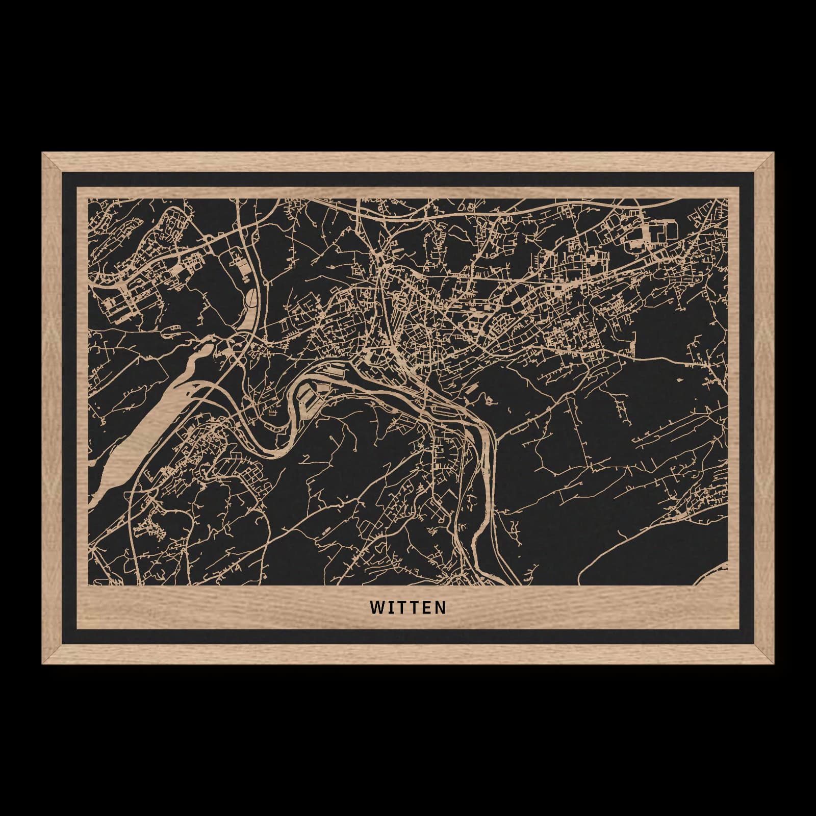
Witten.City Overview
Rectangular wooden city map made from oiled oak – two layers with a black back plate and frame.
About the product
The Ruhr valley and wooded slopes give Witten's neighbourhoods a distinctive setting. Haus Herbede, the railway viaduct and Berger Memorial connect different sides of the riverside city. This broad wooden map also embraces the centre, railway station and Annen. Dense streets, substantial transport links and green hillsides form a varied pattern that explains Witten beyond its individual historic landmarks.
What does the map show?
- West-east reach from Herbede to Annen
- A major crossing at the railway viaduct
- Green heights beside the Berger Memorial
- Precisely cut and engraved
- Fine laser details with clear depth
- Carefully inspected and securely packed
- Handmade in Germany
Configuration
Shape: Rectangular · Design: Framed · Material: Oak · Sizes: 20 × 30 cm, 35 × 50 cm, 50 × 70 cm
The configuration shown in the cart and at the time of ordering is authoritative. The preview is not a dimensioned technical drawing.
Availability & production
- Availability
- Made to order
- Production time
- Ships in 3-5 business days
Production starts after successful payment and complete product configuration.
Materials & care
Depending on the variant, lacquered or oiled MDF or oiled real-wood veneer on MDF; optional stainless-steel mounting screws. Acrylic lacquer spray, hard-wax oil and white glue are used in production.
Wood is a natural material. Grain and color may vary slightly from the product images.
Clean with a dry, soft cloth and protect from prolonged moisture and direct heat.
Included & installation
The selected product in the ordered configuration, securely packed and prepared for installation.
- Maximum dimensions 50 × 70 cm and maximum product weight 2 kg.
- Wall-fixing screws and wall plugs are not included. Use fixings suitable for the wall type, substrate and product weight.
- Installation must be carried out by an adult. Keep optional mounting screws and other small parts away from children until installation.
Shipping & returns
Securely packed shipping. Return and cancellation information is available in the legal section.
Shipping costs and delivery options depend on the destination and format. The published cancellation right applies to non-personalised standard goods; it may be excluded for individually made products.
Manufacturer & product identifier
- Manufacturer
- Benjamin Nöst - Lightworks
Rorichmoorer Str. 76
26802 Moormerland, Deutschland
kontakt@lightworks.de - Product identifier
- LW-CAT-5AB8EB7B102C-S, LW-CAT-5AB8EB7B102C-M, LW-CAT-5AB8EB7B102C-L
Together with the order or production batch, the relevant SKU enables traceability. Safety questions and incidents can be reported to the email address shown above.
Product safety
- Decorative product for dry indoor use only; not a toy and not intended for children.
- Protect from moisture, high heat and open flames.
- Do not continue to hang the product after a fall, breakage or visible damage. Keep damaged parts away from children.
Witten: River bends, woodland and connected districts
Witten belongs to the industrial Ruhr region, yet river and woodland are equally important to its physical character. Herbede, the centre and Annen have distinct urban settings. Bringing them together with the southern heights reveals how transport, older settlements and recreational landscapes contribute to the shape of the wider city.
Crossing a landscape
The Ruhr railway viaduct makes the relationship between engineering and geography especially clear. Railways connect places across a larger region, but they also create strong local lines and crossing points. At the main station, railway land appears as a substantial urban area; at the viaduct, it becomes a crossing of the valley. These are different expressions of the same regional network. River, road and railway do not simply follow one another. Their intersections and changes of direction produce distinctive spaces, helping explain the arrangement of nearby neighbourhoods and routes.
Older places within a larger city
Haus Herbede recalls a history that predates the Ruhr region's intensive industrial expansion. Haus Witten provides another historic reference nearer the centre. Together they show that the area possessed established settlements and local centres long before its later transformation. Their interest lies partly in their present surroundings. Older sites now sit among younger neighbourhoods and transport infrastructure, having been absorbed into a much larger urban landscape. Comparing those settings allows a visitor to read several periods at once, rather than treating each historic building as an isolated survival from a distant past.
Woodland within the portrait
The Berger Memorial draws attention towards the Hohenstein and the city woodland. Here paths and open views replace the tighter divisions of the built-up streets. The southern heights form part of Witten's recreational geography, rather than merely a backdrop to industrial history. The Helenenturm provides another reference between urban areas and higher ground. Bringing these places into the wider view connects western historic sites, central streets and eastern districts with the landscape around them. Witten emerges as a city shaped by older settlement, work and terrain together, with the most revealing moments often occurring where a compact street opens towards the much larger scale of the river valley.
Several directions of growth
Witten's structure becomes clearer when its connections are considered first. The centre occupies a different setting from Herbede to the west and Annen to the east. Residential districts and transport corridors link these areas, reflecting several phases of development. The river landscape establishes another pattern to the south. This is not a city arranged evenly around one central point. It is a group of related urban places whose differences remain legible. Following the routes between them helps explain how they function together, while preserving the particular character of each part.
Sources
- Stadtmarketing Witten: Ausflugsziele — https://stadtmarketing-witten.de/entdecken-erleben/ausflugsziele
- Regionalverband Ruhr: Stadtwald Witten — https://www.rvr.ruhr/themen/orte/filter-orte-detailseite/news/stadtwald-witten-ennepe-ruhr-kreis/
- Ruhr Tourismus: Berger-Denkmal — https://www.ruhr-tourismus.de/poi/berger-denkmal-auf-dem-hohenstein/
- Wikivoyage: Witten — https://de.wikivoyage.org/wiki/Witten

Still deciding?
Configure your motif in the studio and see how your city map will look in your space.